


|
|
|
#1
 07-25-2017, 05:20 PM
|
||||
|
||||
|
Crater Lake, Laser Cut
Hot on the heels of the Ultimate Bar Crawl, and Geography adventure, I came across this artist, Chris Warren, and his model of Crater Lake in Oregon.
He used 28 sheets of mat board to cut the model, and at the elevation of the water surface, placed a sheet of mirrored glass to simulate the water in the crater. I Made This Crater Lake Sculpture With A Mirror Inside | Bored Panda 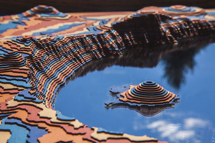 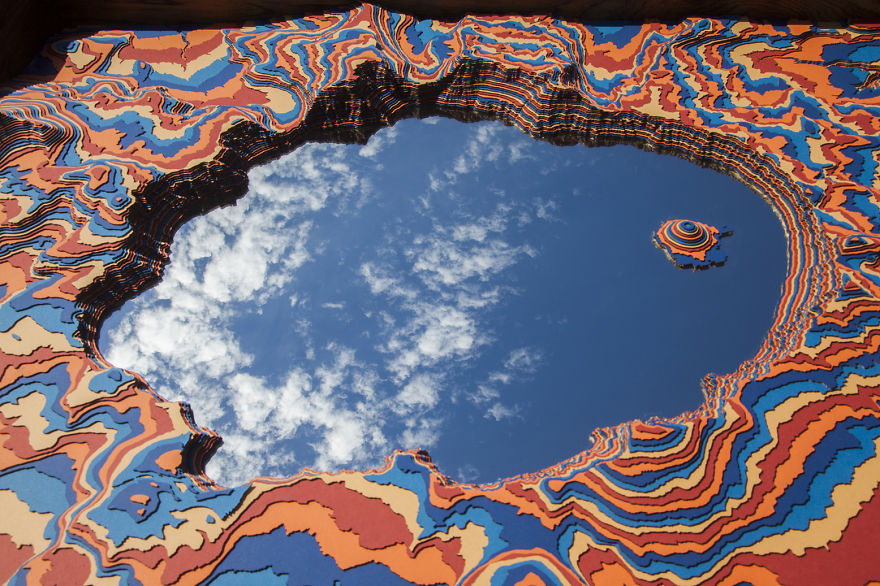 It is paper, just cut a bit differently than what we do Rick
__________________
"Rock is Dead, Long Live Paper and Scissors" International Paper Model Convention Blog http://paperdakar.blogspot.com/ "The weak point of the modern car is the squidgy organic bit behind the wheel." Jeremy Clarkson, Top Gear's Race to Oslo 
|
| Google Adsense |
|
#2
07-25-2017, 05:52 PM
|
||||
|
||||
|
Cor, that brought back some memories. We used to make these relief maps by tracing the contour lines on an Ordnance Survey map onto cereal box card, when I was in primary school. ie: I was about nine, and I'm 73 now. Some times we would smooth over the contour forms with Papier Mache, but I always thought they looked cooler in the stepped form. Especially if we were allowed to cut up the map to glue onto the model. Nowadays I guess you'd just scan and print the map onto the card forms.
__________________
Keep on snippin' ... Johnny
|
|
#3
07-25-2017, 10:23 PM
|
||||
|
||||
|
Pretty cool looking. We used to do the same thing in grade (primary) school with survey maps. Being farmers it was a good way to figure out any terraces we needed to create before getting into moving lots of dirt.
|
 |
|
|


 Linear Mode

